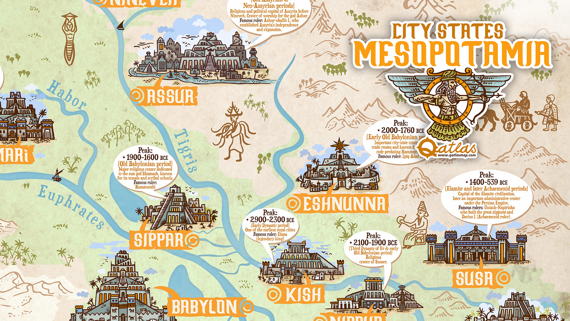
This richly illustrated historical map presents the cities, cultures, and gods of Ancient Mesopotamia in a unique timeline format.
It focuses on the most important urban centers of Sumer, Akkad, Babylonia, and Assyria, placing them in both geographical and chronological context.
It focuses on the most important urban centers of Sumer, Akkad, Babylonia, and Assyria, placing them in both geographical and chronological context.

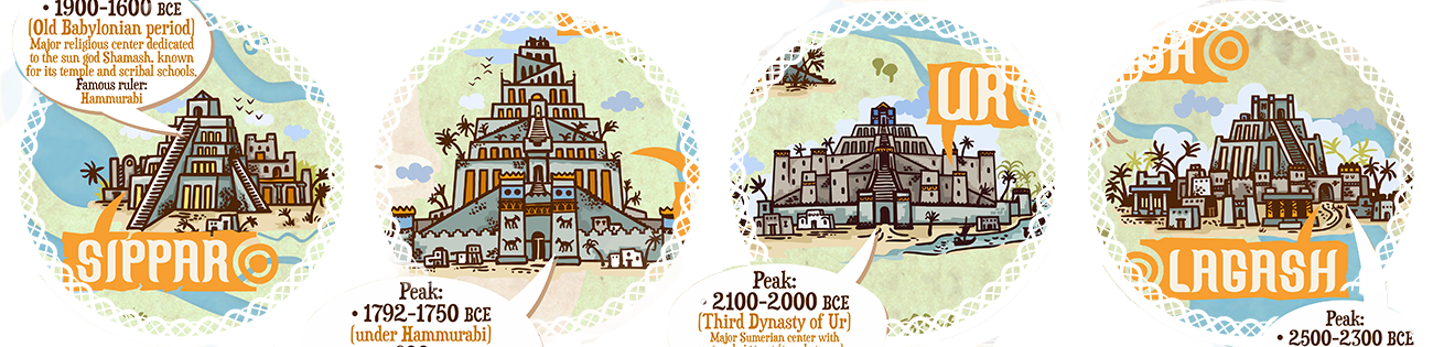
Each city is drawn with individual flair, evoking the look of medieval and early modern maps, and accompanied by brief facts highlighting its golden age.
The goal was not only to map a region, but to visualize the evolution of the world’s first civilizations along the Tigris and Euphrates rivers.
The goal was not only to map a region, but to visualize the evolution of the world’s first civilizations along the Tigris and Euphrates rivers.
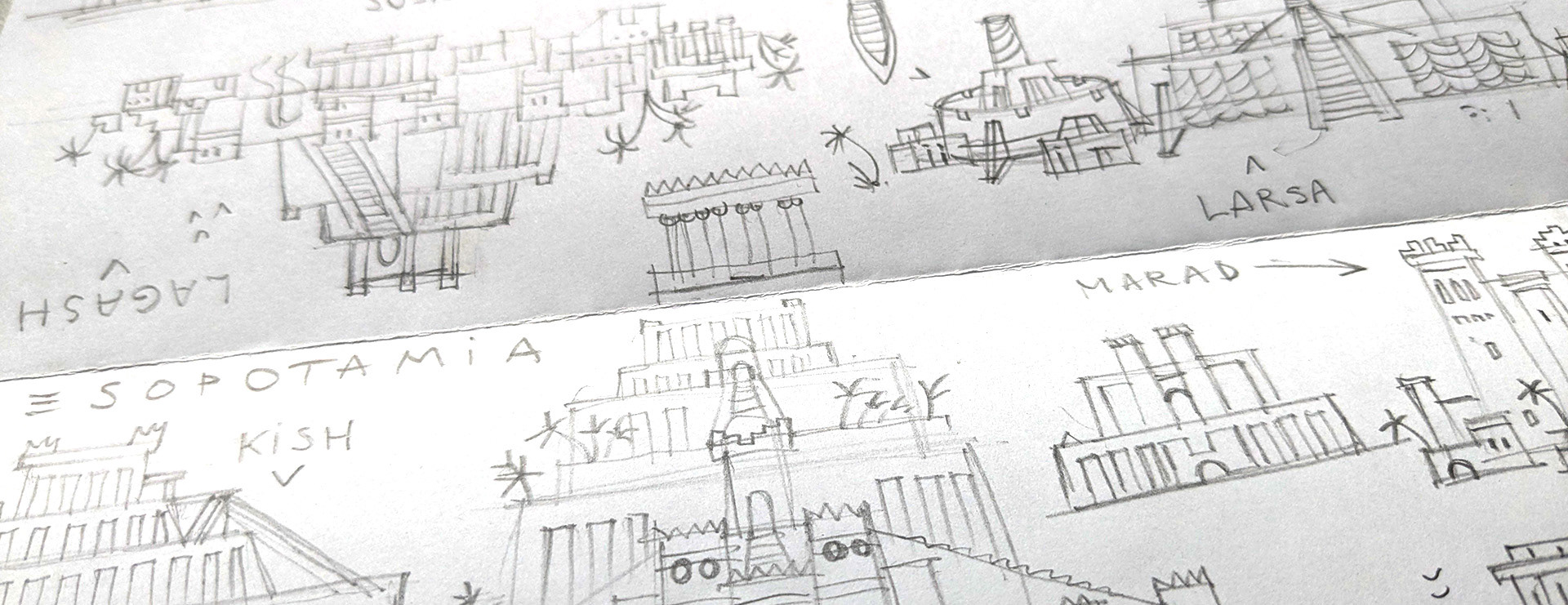
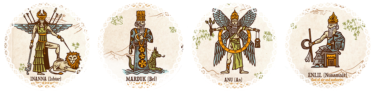
The artwork is a fusion of my hand-drawn sketches, digital painting, and vector illustrations, creating a layered, expressive cartographic style under the Qatlasmap label. The design features not only architecture and cities, but also the major deities of Mesopotamian mythology such as Anu, Enki, Enlil, Utu, Marduk, and Inanna,
making it a true piece of infocartography that blends history and myth.
making it a true piece of infocartography that blends history and myth.
Whether you’re a history enthusiast, an educator, or a fan of ancient storytelling and fantasymap aesthetics, this large-format poster is made to both inform and inspire. A product of the Qatlas project, it celebrates the birth of writing, cities, and gods, right where it all began.